Community concerns need a connected response
The project addresses neighbourhood grievances, human–animal conflicts, and the difficulty of coordinating care across a large city.
THE PROJECT, EXPLAINED
Explore how PawLink is designed to connect animal identity, veterinary care, municipal operations, and citizen participation—in one accountable journey.
A consistent animal registry
From the original capture point
Purpose-bound permissions
Four phases, from setup to support
01 / THE PURPOSE
The presentation introduces PawLink as a digital transformation platform for municipal community dog management, bringing public safety and animal welfare into the same operational system.
Presentation pages 1–4The project addresses neighbourhood grievances, human–animal conflicts, and the difficulty of coordinating care across a large city.
Paper logs and disconnected animal identities can obscure care history, duplicate interventions, and limit visibility into contractor activity.
The proposal links work on the ground to recorded interventions so corporations can review activity, resource use, and evidence of completion.
Page 3 of the presentation frames central RFID guidance, court monitoring, municipal infrastructure, and national reporting as drivers for the project. The controls below describe the proposal’s intended response to those themes.
Read the presentation’s regulatory contextA persistent animal identity designed to reduce duplicate entries and connect the dog to its care history.
Veterinary workflows, GIS analytics, NGO management, digital signatures, and reporting in one architecture.
On-premise deployment in municipal data centres, role-based access, and an append-only record design.
Proposed recognition of the face, muzzle, body shape, and coat patterns to support continuity of identity.
02 / ANIMAL IDENTITY
The registry is the foundation of PawLink’s care journey. An animal’s identity links field records, veterinary interventions, and municipal reporting.
Page 4 proposes subcutaneous, ISO-compliant RFID tags as the animal’s persistent identity. Field scans are designed to connect that identity with the ward, capture location, and subsequent care record.
The animal’s record provides a common reference for field teams, veterinarians, and municipal officers.
Presentation page 4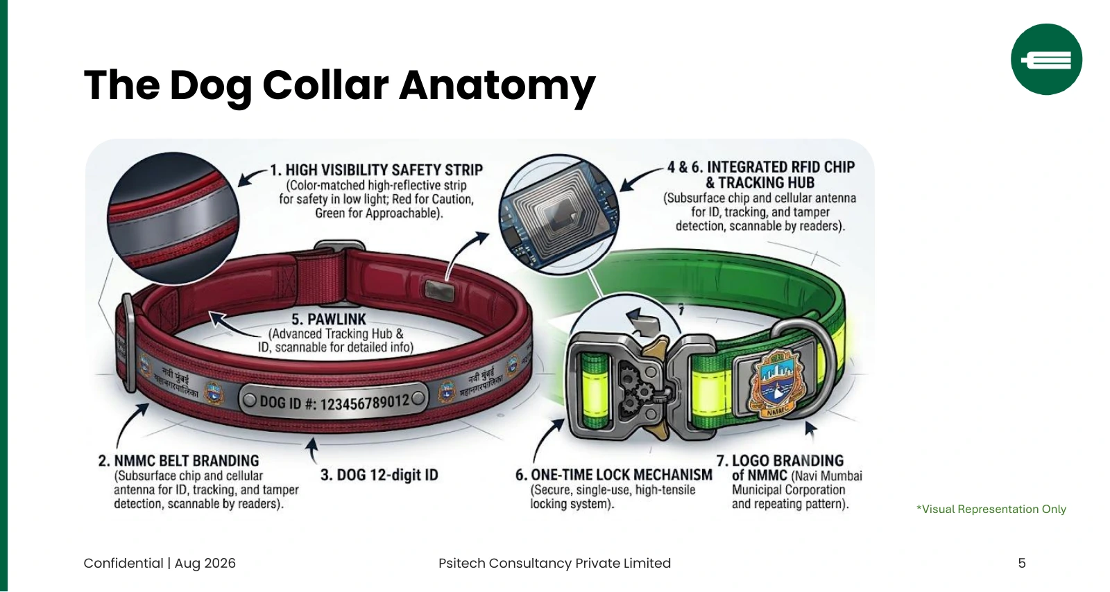
The collar illustration presents a complementary hardware concept: a reflective safety strip, a visible 12-digit dog ID, RFID and tracking hub, cellular antenna and tamper detection, a one-time lock, and example municipal branding.
The presentation describes both the implanted RFID registry and this collar concept. It does not provide a final hardware bill of materials or reader compatibility specification.
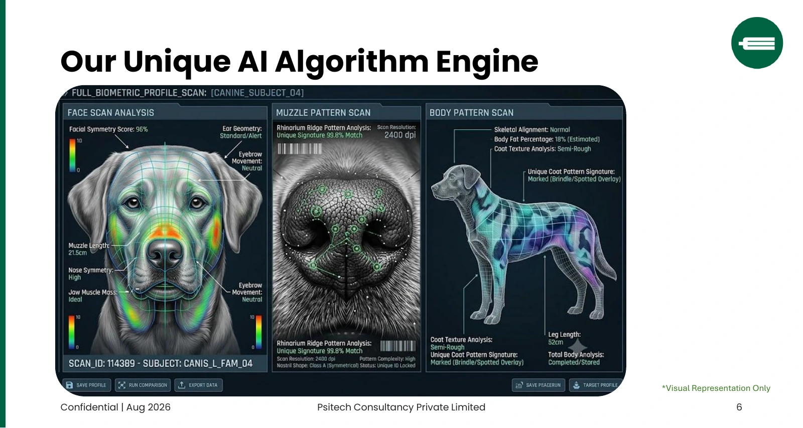
The proposed engine uses visual characteristics to help preserve identity across the care journey. The illustration shows the intended recognition experience; the displayed scores are examples, and the deck provides no validated accuracy benchmark or model specification.
Open the original AI concept slide03 / THE CARE JOURNEY
Five major phases connect the Animal Birth Control (ABC) journey. Select a stage to see its matching photo and the proposed verification steps.
STAGE 01 / IDENTIFY & LOCATE
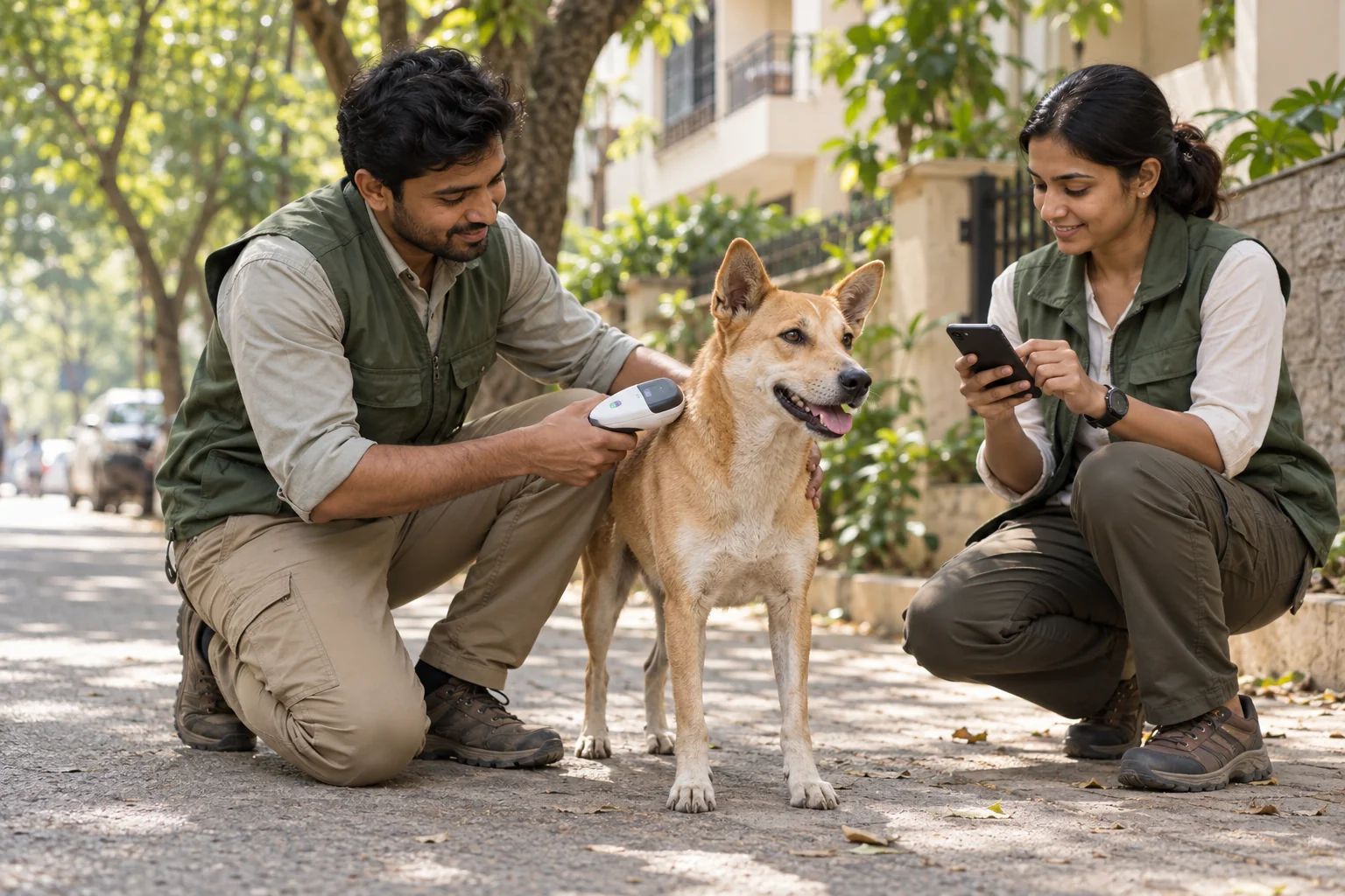
An RFID identity and location record connect a community dog to its ward, creating a consistent starting point for every care intervention.
These controls describe the project proposal. The rollout slide refers to a 12-stage ABC engine, while the workflow slide groups the process into these five major phases.
04 / MUNICIPAL OPERATIONS
PawLink’s proposed operational layer connects ward geography, care coverage, vehicle movements, and NGO performance.
Presentation page 8
This is a projection stated in the presentation, rather than a measured outcome of a PawLink deployment.
05 / CITIZEN COORDINATION
The planned civic layer brings grievances, ward officers, resident welfare associations, and field teams into the same accountability loop.
Presentation page 9Planned web and WhatsApp channels receive citizen incident reports.
The ticket is assigned to the designated ward officer.
Closure requires a GPS-stamped photograph of field action.
The proposal specifies a five-day automatic escalation trigger to the Chief Health Officer.
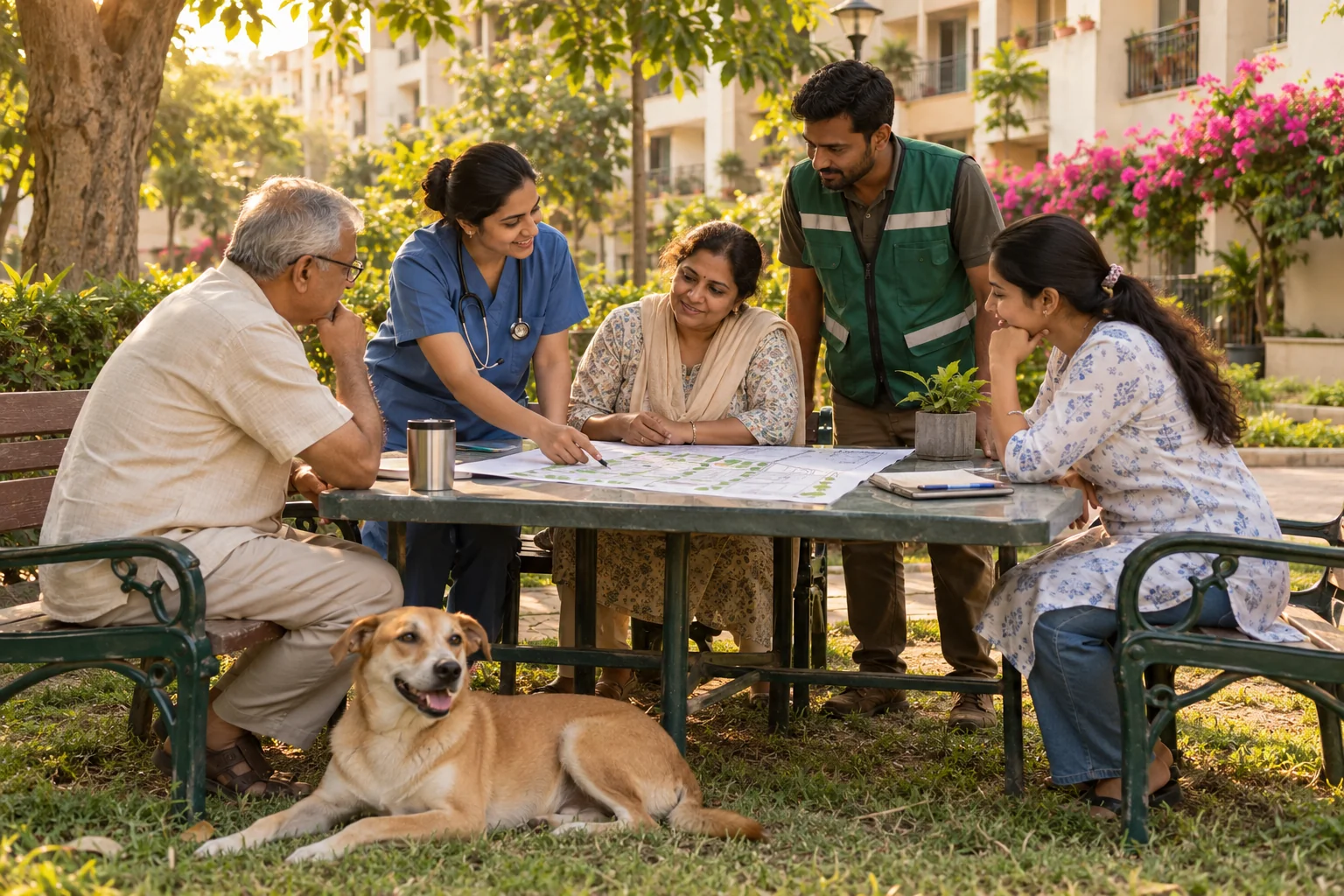
RWA & NEIGHBOURHOOD COORDINATION
The presentation proposes tools for collaboratively mapping designated feeding locations within housing societies and coordinating residents with municipal teams. It also identifies school gates and high-traffic areas as constraints to consider in its location-planning model.
AI CONCEPT PHOTOThe web and WhatsApp channels described here are proposed platform features. For current concerns, use your municipal corporation’s official channels.
06 / DETAILED SPECIFICATIONS
A consolidated view of the technical and operational specifications described across the presentation.
| Area | Specification in the presentation | Source |
|---|---|---|
| Animal registry | Subcutaneous, ISO-compliant RFID identity with connected intervention history. | p. 4 |
| AI identity | Proposed recognition of the face, muzzle, body shape, and patterns. The deck includes a visual concept. | pp. 4, 6 |
| Capture verification | RFID scan and GPS ward validation at the start of the care journey. | p. 7 |
| Intake verification | Timestamped photographs and upload verification during transport and intake. | p. 7 |
| Veterinary approval | Registered veterinarian digital signature for the pre-operation and surgical workflow. | p. 7 |
| Recovery gate | Software-enforced recovery timelines, with a 72-hour gate specified in the control mapping. | pp. 7, 10 |
| Release validation | Release blocked unless GPS is within 200 metres of the capture point. | p. 7 |
| GIS analytics | Official ward shapes, population density, anti-rabies vaccination coverage, and reported bite hotspots. | p. 8 |
| Field accountability | Vehicle tracking, route monitoring, and automated NGO completion metrics. | p. 8 |
| Grievance workflow | Web and WhatsApp intake, ward routing, GPS photo-based closure, and a five-day escalation trigger. | p. 9 |
| Evidence storage | Append-only records and a proposed evidence vault using SHA-256 hashes for export verification. | pp. 4, 10 |
| Reporting | Automated statutory reporting, including quarterly AWBI reports in the proposed mapping. | pp. 4, 10 |
| National integration | Standard APIs intended to synchronise RFID scans, geotags, and health data with the Bharat Pashudhan Portal. | p. 10 |
| Access & deployment | 17 user roles, purpose-bound access, and on-premise installation in municipal data centres. The proposal specifies no third-party cloud data extraction. | pp. 4, 10 |
Page 10 connects the following reference frameworks with intended software controls. This summarises the project’s design mapping, rather than certifying regulatory compliance.
07 / ROLLOUT & INVESTMENT
The presentation proposes four deployment phases, followed by a six-month support service-level agreement.
Presentation page 11Configure on-premise servers, deploy the core system, and ingest official municipal ward boundary data for the GIS layer.
Introduce mobile app frameworks, activate the proposed ABC engine, and provision field-team hardware.
Launch the planned WhatsApp channel, introduce executive dashboards, and test portal integration.
Compare paper and digital records in parallel, expand civic rollout, and transition into the six-month support SLA.
THE PROPOSED FINANCIAL FRAMEWORK
The presentation groups investment into core licensing, consultancy, hardware, and deployment support. It identifies Animal Welfare and Smart City funds as proposed funding routes; no itemised prices are supplied in the deck.
08 / THE FULL PROJECT PRESENTATION
The page follows the supplied 12-slide PawLink presentation by Psitech Consultancy Private Limited. Open a topic directly or download the original PDF.
The project’s closing vision is a partnership with municipal corporations to build proactive, data-informed civic operations.
Explore the benefits for your city